Alternative Geospatial
Our natural curiosity has always driven us to evaluate new technologies and deploy them with our traditional survey methods to elevate our client’s experience, providing them with modern ways to use the data collected in the field. The geospatial solutions team uses drones for aerial LiDAR data, 3‑d laser terrestrial scanning during and post construction, and GIS solutions for utility and infrastructure mapping. These technologies are notorious for collection of millions of points of data. Not only does 4Ward collect the data accurately but we also provide deliverables that are usable by various end users. Our proprietary client portal delivers your geospatial information with all the detail needed in an easy to use and accessible format.
- ALTA / Title Surveys
- Aerial LiDAR Mapping & Control
- Bathymetric Surveys
- Hydrographic Surveys
-
Reality Capture & Terrestrial
Scanning - Sub-Surface Utility Location
- GIS Mapping
- GIS Data Management
4Ward-thinking: How we elevate our processes to incorporate new technologies to deliver best-in-class product
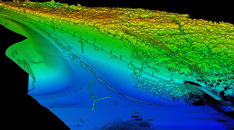
Aerial Data Collection via Topographic Remote Sensing
At 4Ward we utilize unmanned aerial vehicles to enhance and maximize our data collection efforts. We match the quality and usability of a traditional survey file by ground-truthing our LiDAR and GPS observations. We fly and verify!
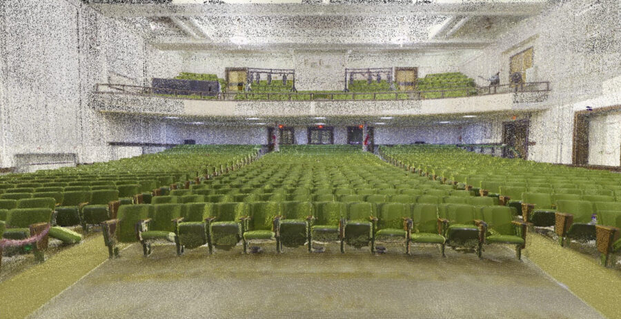
Scanning for Architectural Design
- Middle School in Iowa built in 1925
- 4Ward was engaged to map its existing structures via LiDAR scanning.
- School officials were keenly interested in preserving as much of the history of the campus as possible, with special focus on the Auditorium, having hosted 100 years of school plays, community theater, and town events.
-
The resulting data set included seventeen trillion positional data points and was used to create a remarkably accurate 3‑dimensional model of the school ready to use directly in architectural and civil design software.
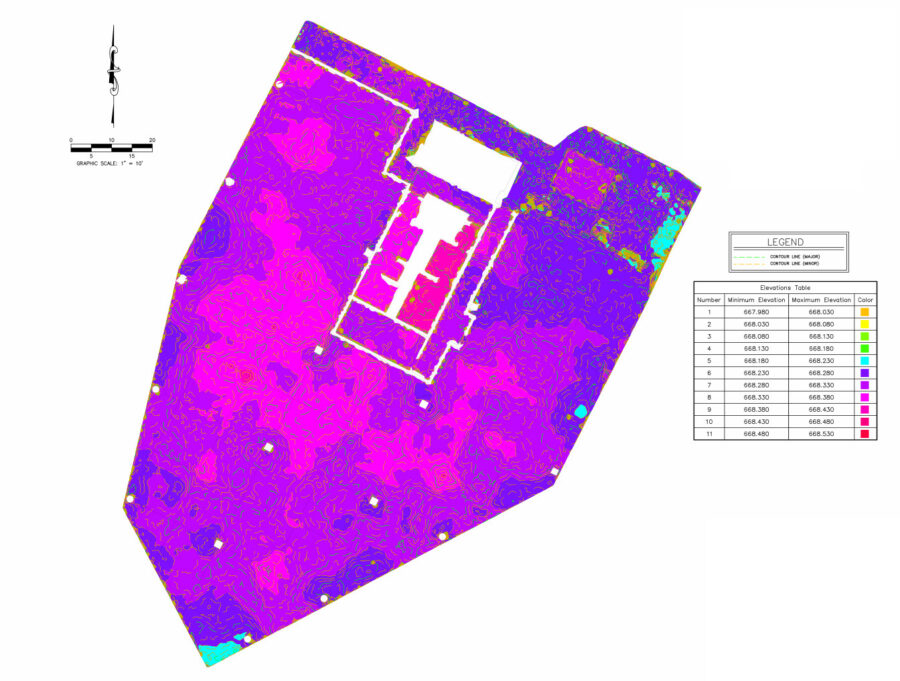
Scanning for Structural Analysis
- Commercial-Use building in Bull Creek area of Austin
- Post construction, building management noticed the ground level floor developing cracks in the concrete.
- 4Ward was tasked with quantifying and documenting the degree to which the ground was shifting for monitoring moving forward.
- Upon completion of an on-site field survey, 4Ward provided the following deliverables to client:
- A “heat-map” style exhibit to show variations in elevation throughout the project
- Standard CAD file for engineering use
- Online hosted virtual walkthrough of the site featuring intuitive analysis tools for displaying areas of pooling for quick reference and communication
GIS Data Management Solutions
With our beginnings firmly rooted in surveying, at 4ward we appreciate the value of field verification. Our process always features collecting data in the real world to use as a basis for our databases. This results in survey-grade accurate location information and allows our clients access to design-ready files for when they need to maintain or improve their current infrastructure.
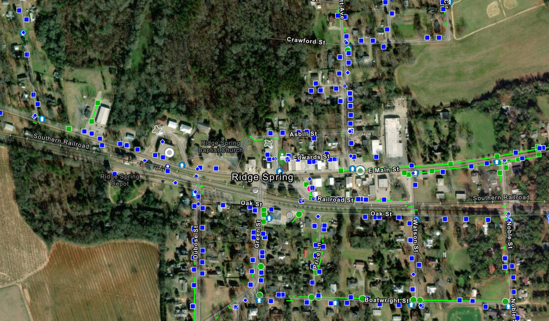
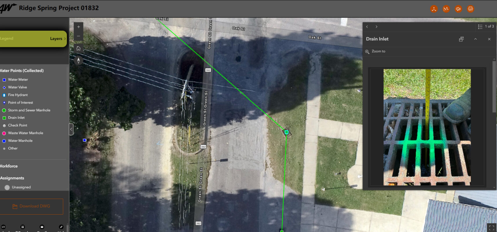
Use-Case: Municipal Asset Inventory
- Small town in South Carolina needed an inventory of their water and storm sewer infrastructure.
- Challenges: limited resources, aging infrastructure, and inadequate records to plan and design from
-
4Ward’s solution:
- Created survey-accurate geo-referenced image of town by flying UAV 40+ miles of roadway over town’s water service area
- Deployed out and located every water valve, water meter, water manhole, and fire hydrant on the ground with Trimble GPS equipment
- Photographed features located, notating the depth and condition as we went
- Final product delivered was a web-based secure GIS system to house all the data for their long-term use
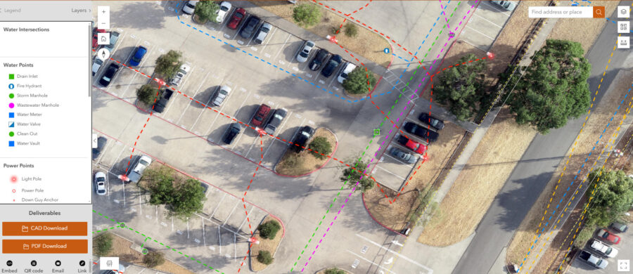
Use-Case: Site Development
Driven by curiosity and our passion for surveying, 4Ward has expanded into subsurface utility surveying. We recognized the need to offer this service through our cultivated relationships with civil engineers who are engaged in site development projects that require a detailed understanding of a site’s constraints to design and construction. In order to provide an elevated deliverable that would maximize data collection for our clients, we developed our 4Ward Project Mapping Viewers. These viewers function as a site data management interface housing CAD files, utility and property records, and geo-located site photos all overlaid on low altitude orthometric images that have been aligned with project control monuments.